Skip to content Skip to footer

The Achaean colony of Kaulonìa (also called Kaulon or Caulon) has been identified in the present-day Monasterace Marina, a village on the Ionian coast of Calabria located at the border between the provinces of Reggio Calabria and Catanzaro. The archaeological site, discovered by Paolo Orsi during the first decades of the XX century, provided us with important data about the extension of the city walls and the location of sacred sites, necropolises, and some residential areas.

Like other colonies in the area, Kaulonìa was founded by Achean settlers. Some scholars suggest that it might be a sub-colony of Croton (709-708 B.C.).

Such an interpretation would explain the strong influence that Croton had on Caulon in the earliest ages. However, some recent archaeological discoveries suggest a more ancient origin of the city. Caulon could have been founded by settlers coming directly from Greece around the last quarter of the VIII century B.C.

After the defeat of Croton in the battle of Sagrafought against the Greek colony of Epizephyrian Locris (around the half of the VI century B.C.), Kaulonìa became more autonomous and developed some economic activities that facilitated its growth and influence in the area. Its strengths resided undoubtedly in the sale of straight timber, the production of pitch (both essential for shipbuilding), and mining.

However, the city failed to affirm its power in the area, as the scarce agricultural production and the rise of rival colonies did not allow Caulon to expand.

The reasons behind the abandonment of the city are not clear either. Only some dates related to wars and destruction are certain: in 389 B.C. the tyrant Dionysius I of Syracuse, destroyed the city, while in 280 B.C. it was devastated by the Campanians, allied with the Romans against the invader Pyrrhus. In 205 B.C. the city was conquered by the Romans.

Unfortunately, the abandonment is ascertained only by sources dated 200 years later (Pliny the Elder and Strabo) and therefore the archaeologists cannot shed light, at least for now, on the latest events of this city of Magna Graecia.

The archaeological investigations have ascertained the presence of a statio, a fortified post built at the end of the republican age (I century B.C.) along the road that connected Tarentum (Taranto) with Rhegium (Reggio Calabria). The sources mention it with different names (Caulon, Stilida, Cocyntum) and the presence of rural villas in the area is confirmed until the end of ancient history.

The Doric temple of Kaulonìa seen from a drone at sunset

The site of Kaulonìa

Right in front of the sea, a few meters from the Archaeological Museum of Ancient Caulon and not far away from the place where the ancient Promontory of Cocynthum should have been located, there are the remains of a Doric temple built in the second half of the V century B.C. According to some scholars, it was dedicated to Zeus Homarius.

Its foundations measure 41 x 18 m and it was encircled with 36 columns along the external perimeter. It was, therefore, a peripteral and in antis temple.

Not much has been preserved of the structures: of all the columns, only a drum in Doric style and a capital have survived. Based on this data, the scholars have estimated the height of the colonnade to be approximately 5 meters. There are a number of fragments of the upper parts, including from the cornice: their original colours were black/blue and red.

Paolo Orsi, the first scholar who started excavation works in the temple in 1912-1913, also found the roof tiles made of the precious Parian marble from Greece.

The sanctuary incorporated the previous site and was attended since the VI century B.C., as documented by the discovered remains. The actual Doric temple was built around 430-420 B.C. and was active only for a few years, as the tyrant Dionysius I of Syracuse destroyed the city in 389 B.C.

As we have only a few information on the abandonment of the Greek city, it is almost certain that its construction materials were already looted in Roman times.

Nevertheless, many intact roof tiles were found in various layers of the collapsed structure.

The quadrangular city walls of Kaulonìa encircled the entire acropolis (that has now been identified with a hill named Piazzetta) and stretched out through the coast and the hills to the west.

It was composed of 11 towers with heights varying between 3 and 5 meters, depending on the morphology of the soil and the defensive planning.

The construction of the city walls covers a long chronological period from the VII-VI century B.C. till the III century B.C. The building technique may be assimilated to rubble (“sack”) masonry, i.e. pebbles and limestone rubble put between two revetments. The end parts and the corners are reinforced with larger and better-squared blocks of various origins. Along the perimeter, there were at least four doors that, at least in one case, present very advanced strategic and defensive solutions.

The urban planning of the ancient city, based on the archaeological surveys’ results, had a rational organization with streets perpendicular to each other. There were also ordinary houses overlooking these streets, built with a central yard around which the various rooms were distributed. A well-preserved example is represented by the “House of the Dragon” that draws its name by the splendid polychrome mosaic discovered at its doorstep.

A zenital view highlights the site plan of the temple
Plan of a section of the city walls, hill A, towers IV and V. On the right below, a reconstruction proposal (from the archives of the Archaeological Superintendency of Calabria)
A drawing of the “tenaille” gate (archives of the Archaeological Superintendency of Calabria)

Insights

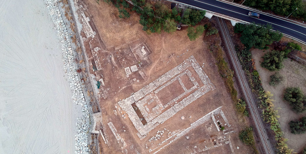
After the excavation campaigns led by Paolo Orsi, carried out from 1911 to 1916 and focused essentially on exploring the Doric temple and the city walls, there was a long period of inactivity, broken only in the 1950s by some topographic studies led by G. Schmiedt and R. Chevallier.

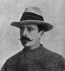
                                                                                 The archaeologist Paolo Orsi

In the following decades, several explorations were carried out: first, the “House of the Dragon” by Alfonso De Franciscis, followed by Bruno Chiartano’s surveys near the temple and then by the surveys led by Elena Tomasello on city walls and one sector of the settlement.

Only in the 1980s the archaeological investigations on the Achaean colony of Kaulonìa resumed in a structured manner, thanks to the commitment and perseverance of the then-Superintedent Maria Teresa Iannelli who initiated a number of collaborations with international schools and institutions.

The systematic research conducted in the last 15 years covered almost exclusively the seafront of the city: the Università degli Studi and the Scuola Normale Superiore of Pisa carried out their surveys in the area of the temple, whilst the Archaeological, Fine Arts and Landscape Superintendency of Reggio Calabria and the Provincial Council of Vibo Valentia, with the contribution of the Università Mediterranea of Reggio Calabria and the Università della Calabria, are working in the area of the complex of Casamatta; last but not least, the Università degli Studi of Florence does its research in the northern area of the settlement, called S. Marco, since 2003.

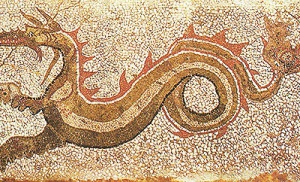
                                                      The mosaic that gave the name to the House of the Dragon

Recently, many efforts have been done to secure the site facing the sea. As it has been frequently hit by sea storms in recent years, the site risks to disappear forever.

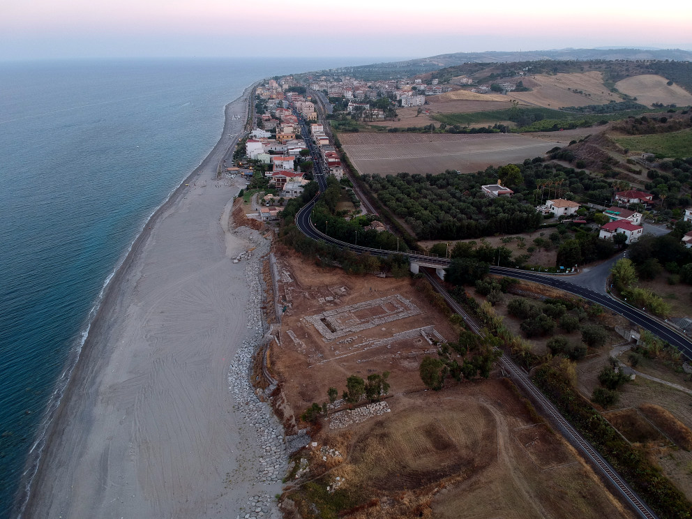
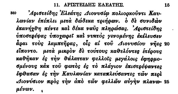
The spot where the ancient Kaulonìa was situated was an essential landmark for navigation and for ancient geographers. It is the Cocynthum Promunturium quoted by, among others, Polybius e da Pliny the Elder in his Naturalis Historia. It was considered one of the landmarks that defined the shape of Italy. The size of its protruding point seems to have been emphasized with respect to reality, even in the post-classical age. Scholars explained this in different ways, but the root cause is to be found in its importance for navigation to and from the coasts of Greece and to the “simplified” vision that the ancient peoples had of sea routes, as it clearly emerges from peripli or itineraries of that time.

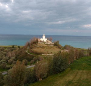
                       The lighthouse of Punta Stilo, built in 1891 in proximity of the ancient Promontory of Cocynthum

It is not clear when the change of the toponym of the area took place. In some late-medieval and modern portolan charts, the area is just mentioned as “Stilo” or “Stillo”, a name that in all likelihood refers to the sole column visible from the sea.

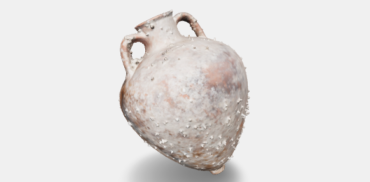
From a nautical point of view, Punta Stilo is located in a particularly favourable place, also thanks to the presence of two torrents (Stilaro and Assi) that flow exactly into the area. This is confirmed by archaeological discoveries from the Neolithic, when it was an important centre for obsidian trade. This situation did not change in the following centuries, as confirmed by the discovered amphorae.

Starting from these premises, some underwater discoveries allow for assuming that there was a canal harbour in the area, probably at the mouth of the torrent Assi. The torrent, up to 150 years ago, had still an internal residual lake right by its mouth. The hypothesis of an inland port basin finds its proof in other ancient settlements on the Ionian coast. There could also have been a landing place of a more traditional type, with simple slipways on the beach, as reported by Thucydides when he mentions a lumber cargo for shipbuilding in Kaulonìa.

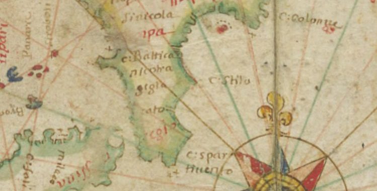
                  Capo Stilo in the Nautical Atlas by Roussin, 1659 (Source: gallica.bnf.fr /Bibliothèque nationale de France,                                                                            département Cartes et plans, CPL GE DD-2022)

The ancient Cocynthum Promunturium, later called Punta Stilo, was undoubtedly an important landmark for navigation during the post-classical age.

During the Byzantine domination, its harbour was certainly active to support the commerce from and to the Cattolica and the Kastron of Stilo. Some Arab incursions, documented by a number of sources, could have used the ancient harbour as their landing place.

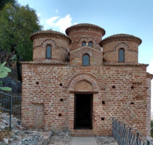
                                                                                        The Cattolica of Stilo

Cuteri F. A. 1997, La Chatolica antiqua e il Kastron di Stilo: note archeologiche e topografiche, in Vivarium Scyllacense VIII.2, pp. 59-90

Givigliano G.P. 1994, Percorsi e strade, in AA.VV., Storia della Calabria, II, Reggio Calabria, pp. 241-362

Greco F. 1996, Porti della Magna Grecia. Topografia e storia, in (a cura di) PRONTERA F., La Magna Grecia e il mare. Studi di Storia Marittima, Taranto 1996, pp. 173-188

Iannelli M.T., 1997, Il tempio sommerso di Caulonia, in (a cura di) COSTABILE F., L’architettura samia di occidente dalla cava al tempio. Siracusa, Locri, Caulonia, Soveria Mannelli (CZ), pp. 69-83

Iannelli M.T., Lena G., Mariottini S., 1993, Kaulonia – Rinvenimenti archeologici e subacquei tra il tempio dorico e il fiume Assi, in Asubacq I, pp. 1-20

Medaglia S. 2002, Materiali erratici dal mare di Kaulonia, in Archeologia Subacquea, Studi Ricerche, Documenti, III, pp. 163-185

Medaglia S. 2002, Il porto di Caulonia: testimonianze letterarie ed evidenze archeologiche, in Magna Graecia. XXXVII, 1-2, pp. 13-15, 24-25

Orsi P., 1916, Caulonia I, memoria, in MemLinc XIII

Prontera F., 1996, Sulla geografia antica e sulla rappresentazione litoranea della Magna Grecia, in (a cura di) Prontera F., La Magna Grecia e il mare. Studi di Storia Marittima, Taranto 1996, pp. 281-298

Schmiedt G. 1967, Antichi Porti d’Italia, II, in L’Universo I, pp. 2-44,

Schmiedt G. 1978, I porti italiani nell’alto medioevo, in La navigazione mediterranea nell’alto medioevo, Settimane di Studi del Centro Italiano di Studi sull’alto medioevo, I, Spoleto (1977), pp. 129-254

Schmiedt G., Chevallier R. 1959, Caulonia e Metaponto. Applicazioni della fotografia aerea in ricerche di topografia antica nella Magna Grecia, in L’Universo XXXIX 2 e 5, Firenze 1959

Porphirii., Vita Pythagorae., 56: “Πυθαγόραν δὲ κρατουμένων τῶν φίλων τὸ μὲν πρῶτον εἰς Καυλωνίαν τὸν ὅρμον σωθῆναι, ἐκεἶθεν δὲ πάλιν ἐς Λοκρούς”

“(…) And that Pythagoras, after the defeat of his followers, repaired first to the port of Caulonia, then he moved towards Locri (…)”. (…)”.


Thucydides, VII, 25, 2: “(…) καὶ τῶν τε πλοίων ἐπιτυχοῦσαι τὰ πολλὰ διέφθειραν καὶ ξύλα ναυπηγήσιμα ἐν τῇ Καυλωνιάτιδι κατέκαυσαν, ἃ τοῖς Ἀθηναίοις ἑτοῖμα ἦν”.

“(…) and the timber, which for building of galleys the Athenians had ready framed, [the Syracusans] burned in the territory of Caulonia (…)”. (…)”

Polyaenus., 6, 9, 11:

“When Dionysius was besieging Caulonia, Aristeides of Elea sailed with twelve ships to relieve it, and Dionysius advanced against him with fifteen ships. Aristeides retreated to avoid this superior force, and, as the night came on, he ordered torches to be lighted. He removed these torches by degrees, and instead he lit others, which he floated upon large corks. Dionysius was distracted by the lighted corks and directed his course so as to keep them in view, expecting to bring the enemy to battle in the morning. Meanwhile Aristeides tacked about and steered for Caulonia”.

Museum and Archeological Park of Ancient Claulon

The Museum and the Archeological Park of ancient Kaulon are located near present-day Monasterace Marina on the Ionian Sea, alongside the Strada Statale 106 Ionica and the Reggio Calabria-Taranto railway. It is managed by the Polo Museale della Calabria of the Italian Ministry for Cultural Heritage and Activities (MIBAC).

The Museum has on display mainly the artefacts recovered from the ancient Achaean colony during the excavations works carried out by Paolo Orsi at the beginning of the last century, along with those found recently, i.e. since the 1980s, which allowed for conducting the surveys of the settlement and the sacred areas.

A section of the museum contains some important underwater discoveries made by Associazione Kodros, led by Stefano Mariottini.

In particular, there are architectural elements (upper parts and bases of columns from the V century B.C.) and some equipment (anchor stocks, weighting bars, weights etc.), described in the data cards of our virtual museum.

The nearby Archaeological Park is located in a suggestive landscape. It is accessible from the Museum via an underpass in order to avoid the crossing of the dangerous Strada Statale 106. From there, between the modern road and the sea, an archaeological route crosses the various residential sections of the ancient city and ultimately reaches the monumental Doric temple.

A view of the Archaeological Park of Kaulonìa
The documentation of the artefacts of underwater origin on display at the Museum

The submerged archaelogical area

The first reports of sunken archaeological material in the sea in front of the Doric temple of Kaulonìa date back to 1935. The first underwater archaeologist that dived in the area was G. Kapitän who in 1967 found the column drums and other worked materials, attributing them to a wreck.

The German scholar, like the others before him, did not consider that the whole coastal area is made of an arenaceous formation subjected to powerful phenomena of marine ingression and subsidence, suffering a constant retreat of the coastline that gets literally swollen by the sea due to its unstable tectonics.

The underwater surveys, carried out for more than 30 years by Associazione Kodros led by Stefano Mariottini in collaboration with the Archaeological Superintendency of Calabria (M.T. Iannelli), concerned the stretch of coast from the Doric temple to the river Assi, with a particular attention to a rectangular sector of 500 x 250 m where approximately 200 blocks of construction materials are scattered. These can be classified as belonging to the Greek Trilithic system (40 column drums, 25 semi-finished blocks, 124 other blocks, 2 column bases, 2 mooring cleats). The petrological analyses allowed for distinguishing limestone, sandstone, schist, and skarn; marble was found only in one case.

The interpretation of this site is not easy, but thanks to some recent geomorphological studies, it was possible to ascertain that the whole area has been subjected for millennia to heavy phenomena of erosion, subsidence ed eustasy. Therefore, it is evident that in the past, the area was to be above the sea level and the following interpretative hypotheses could be formulated:

1) The area was a worksite for construction materials, imported by sea and unloaded in the nearby docks. The two recovered cleats seem to be a good indication of a nearby mooring site.

2) It was a work site for the construction of an Ionic temple.

The dismantling of old buildings should be excluded due to the complete absence of reused materials.

A potential paleo-environmental reconstruction would suggest that the area was part of a dunes’ complex, subsequently swallowed up by the sea and located close to a port basin or to a canal harbour. The place is probably to be identified with the Promontory of Cocynthum that the sources locate close to Kaulonìa.

Archaeological surveys of the sunken site of Kaulonìa. In the foreground, some column drums (photo: P. Palladino)
The MUSAS project archaeologists, assisted by Carabinieri Scuba Divers while examining the sunken structures of Ancient Caulon (photo: P. Palladino)
The recovery of the column base no. 72 in the ancient worksite, now submerged, between the torrents of Stilaro and Assi (photo 1994, Associazione Kodros. Archives of the former Archaeological Superintendency of Calabria)

Barello F. 1995, Architettura greca a Caulonia, Firenze

Iannelli M.T. 1989, Kaulonia – Un piano programmatico di ricerca, in Treziny H., Kaulonia I, Napoli, pp. IX-XV

Iannelli M.T. 1997, Il tempio sommerso di Caulonia, in (a cura di) Costabile F., L’architettura samia di occidente dalla cava al tempio. Siracusa, Locri, Caulonia, Soveria Mannelli (CZ), pp. 69-83

Iannelli M.T., Lena G., Mariottini S. 1993aKaulonia – Rinvenimenti archeologici e subacquei tra il tempio dorico e il fiume Assi, in Asubacq I, pp. 1-20

Iannelli M.T., Lena G., Mariottini S. 1993bArcheologia Subacquea: la tutela del patrimonio sommerso, in Ambiente Salute Territorio VII, 2, pp. 43-44

Lena G. 1997, I materiali del tempio Marasà a Locri e del tempio sommerso a Caulonia. Analisi geologica, in (a cura di) Costabile F., L’architettura samia di occidente dalla cava al tempio. Siracusa, Locri, Caulonia, Soveria Mannelli (CZ), pp. 85-101

Medaglia S. 2002, Materiali erratici dal mare di Kaulonia, in Archeologia Subacquea, Studi Ricerche, Documenti, III, pp. 163-185

Medaglia S. 2002, Il porto di Caulonia: testimonianze letterarie ed evidenze archeologiche, in «Magna Graecia» XXXVII, 1-2, pp. 13-15, 24-25

Insights

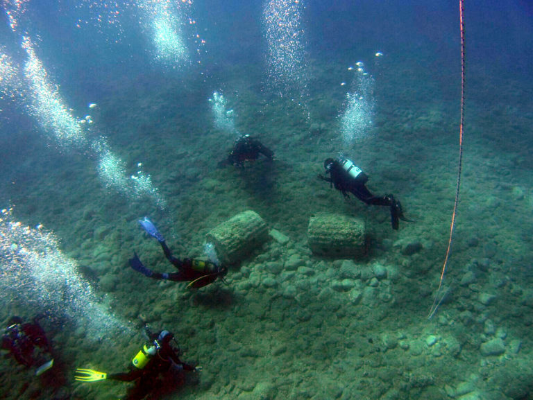
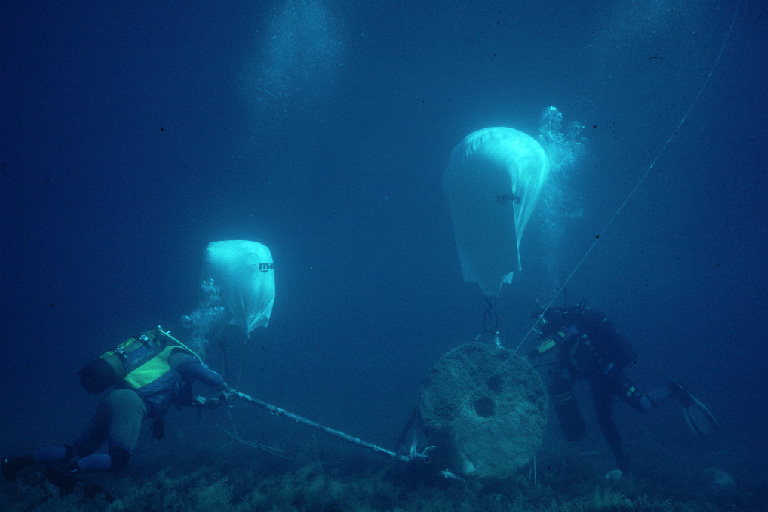
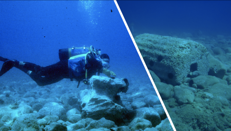
In this important site, underwater archaeology does not focus only on ancient times.

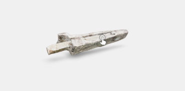
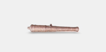
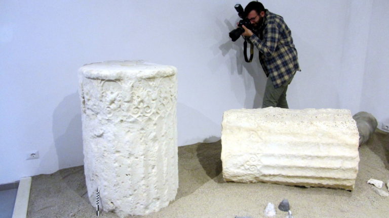
In 1996, Stefano Mariottini reported the discovery of four submerged cast-iron cannons in front of the Archaeological Museum of Monasterace. The said cannons, catalogued as R69, R70, R74 and R75, lied in pairs (R69-R70 and R74-R75) at a depth of about 3 m, in two distinct areas parallel to the coastline, distant 82 meters from each other and approximately 35 meters from the shoreline. A further examination of their underwater positioning allowed for ascertaining that the cannons were close to a bump, parallel to the shoreline and oriented towards the land. This bump generates an unexpected bathymetric variation that can be interpreted as a previous mid-littoral plane. The heavy weapons, normally an indication for the presence of a wreck, in this case are not included in a shipwreck context, as no remains of a ship or other discoveries that may have indicated its presence were found. All the cannons are of the same type, even though found in two separate groups; we may hypothesize that they were rather thrown into the sea, probably during a sea storm, to lighten the ship and facilitate its navigation.

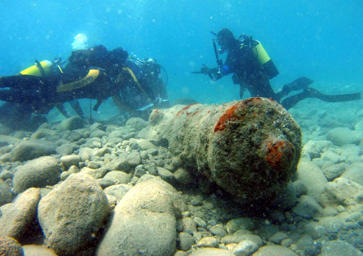
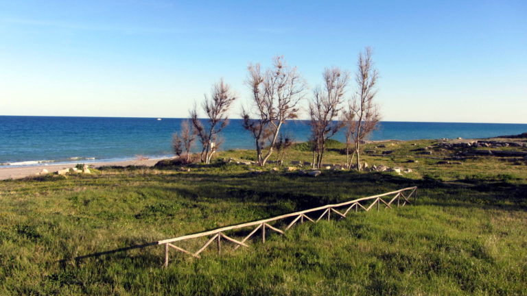
            The archaeologists of the MUSAS project while examining the cannons of Monasterace (photo: P. Palladino).

The classification of these weapons varies according to their dating and manufacture. It is not easy to assign a dating or a production to cast-iron cannons; unlike bronze cannons, usually rich of decorative elements and inscriptions, cast-iron pieces are often anonymous, with only a few, similar types, and scarcely studied in Italy.

In our case, the style and the construction technique allow for narrowing down the date interval to the XVII century.

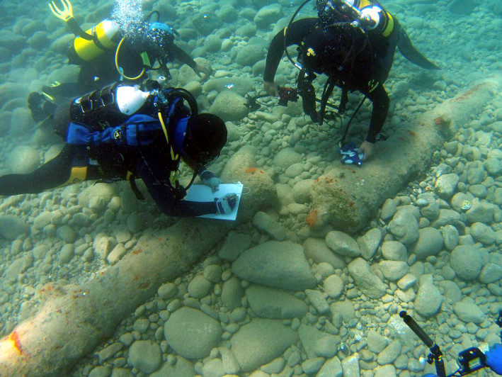
                                                  The first surveys on cast-iron cannons (photo: P. Palladino)

BROWN R. R. 1997, Arms and armour from wrecks: an introduction, in REDKNAP M. (a cura di), Artefacts from wrecks, Oxbow Monograph, 84, pp.101-109

BROWN R. R. 2011, “A jewel of great value”English iron gunfounding and its rivals, 1550-1650, in BELTRAME C., RIDELLA R. G. (a cura di), Ships and GunsThe sea ordnance in Venice and in Europe between the 15th and the 17th century. Oxford, pp. 98-105

BROWN R. R. 2015, 16th and 17th century cast-iron English guns in Polish collectionsICOMAM Magazine, 14, pp. 38-40

CIPOLLA C.M. 1969, Velieri e cannoni d’Europa sui mari del mondo, Torino

IANNELLI M.T., MARIOTTINI S. 2009, Rinvenimenti subacquei nel territorio di Caulonia, in PAOLETTI M. (a cura di), Relitti, porti e rotte nel Mediterraneo, Cosenza, pp. 133-136

LENA G. 2009, Geomorfolgia della costa ionica della Calabria e strutture portuali antiche, in PAOLETTI M. (a cura di), Relitti, porti e rotte del Mediterraneo, Cosenza, pp. 35-86

SCHUBERT H. 1949, The Superiority of English Cast-Iron Cannon at the Close of the Sixteenth Century, in The Journal of the Iron and Steel Institute, 161, pp.83-86

SCOTT S. S., BROWN R. R. et al. 2008, The Great Guns Like Thunder: The Cannon from the City of Derry, Derry

SICKING L. 2015, European naval Warfare, in SCOTT H. (a cura di), The Oxford handbook of early modern european history, 1350-1750, vol. II: cultures and power, Oxford

TROLLOPE C. N. 2002, The design and evolution of English cast iron guns from 1543 to 1660, in Journal of the Ordnance Society, 14, pp. 51-63

TROLLOPE C. N. 2005, The design and evolution of English cast iron guns from 1543 to 1660, in Journal of the Ordnance Society, 17, pp. 49-58

Biological degradation of column drums and other submerged stone artefacts

The artefacts lie at a depth of 6-7 meters on a sandy seabed, characterised by the presence of granitoid and calcareous rocks. The study area covers approximately 200 x 300 m2. Around 200 objects were classified.

The artefacts include column drums, semi-finished blocks and two mooring cleats. They bear different petrographic characteristics that influenced the preservation state of each piece. In fact, the column drums are made of calcareous rocks, just like mooring cleats and some semi-finished blocks. The other semi-finished blocks were made of sandstone, marble and skarn.

Underwater images of a mooring cleat and one of the column drums (photo: Stefano Mariottini)

The position of these submerged artefacts made them an ideal growth substrate for a multitude of animal and vegetable micro-organisms and organisms. As these substrates were rigid, large and heavy, they barely moved from their original position. Therefore, they allowed for the development of epilithic forms of life that could not have developed with the same intensity on smaller cobbles that are more likely to be moved by hydrodynamics.

Column drums and mooring cleat on the seabed of the Ancient Caulon

Over time, the calcareous artefacts, i.e. the majority of the findings, suffered from bioerosion phenomena caused by the endolithic growth of animal and vegetable organisms capable of actively perforating the substrate.


Altogether, the biological colonisation phenomena are homogenous with subtle variations related to the “underwater history” of every single piece, especially related to the silting occurred over time.


The figures show some examples of the alternation of silting and emergence phases on the mooring cleats over time. The phases during which the surfaces were exposed have resulted in a rapid biological growth; the majority of these organisms die during the silting phases.

A graphic representation of the different phases on a column drum on the basis of photographic documentation. Some original images are visible in the spheres. (photo: Stefano Mariottini)

State of preservation

The column drums are currently colonised by algal growths (especially of Padina pavonica and Acetabularia acetabulum) with calcareous patinas of annelids and sedentary worms, shells of bivalve molluscs (Chama and Ostrea sp.) and slight signs of encrustations caused by the development of red algae (Corallinaceae).

In the three images above: Ostrea sp. on column drums. In the three images below: Chama sp. on column drums.

These epilithic growths are widespread on the uppermost part of the artefacts and were subjected to variations in their morphology and intensity, depending from the seasons and the levels of silting that might have inhibited or totally impaired their growth.

Moreover, it is interesting to point out that these artefacts, considered as “new” materials for the site environment, are largely used by vagile fauna for grazing. An example of this are gastropods such as Trunculariopsis trunculus and sea urchins (Paracentrotus lividus).

Column section no. 73 with evident traces of biological colonisation.

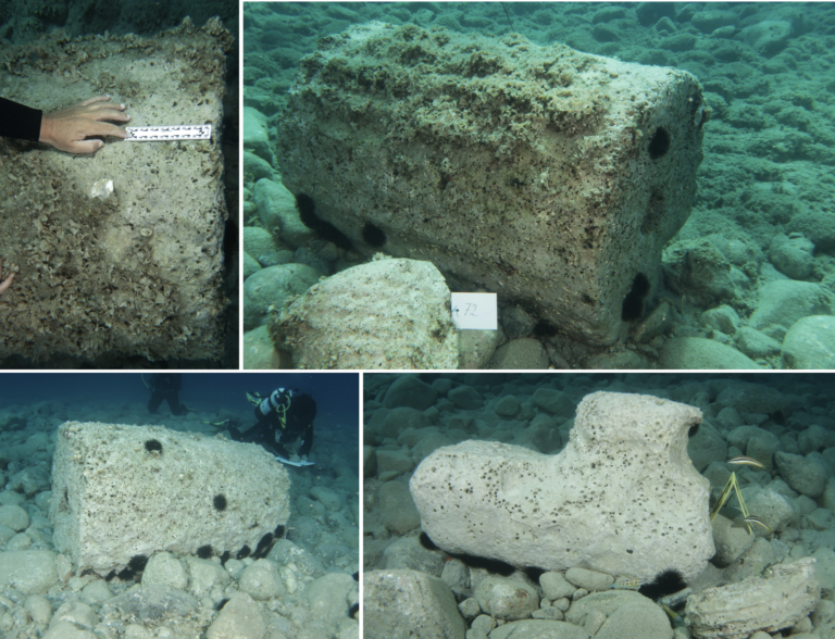
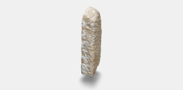
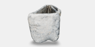
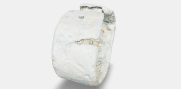
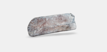
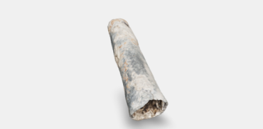
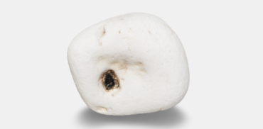
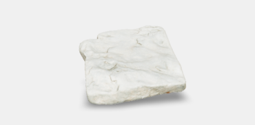
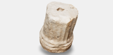
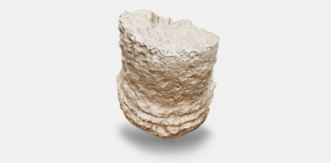
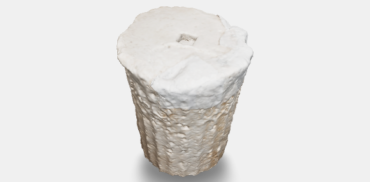
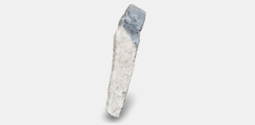
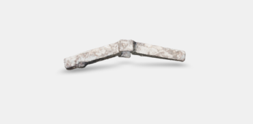
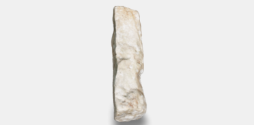
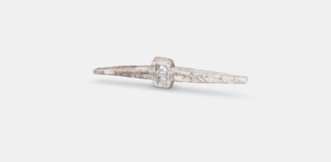
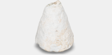
Nearly all the artefacts made of carbonate rocks suffered from a conspicuous alteration of the stone, caused by the endolithic development of boring bivalve molluscs, whose presence is highlighted by circular or paired holes, sometimes thickly grouped, visible on the surface.

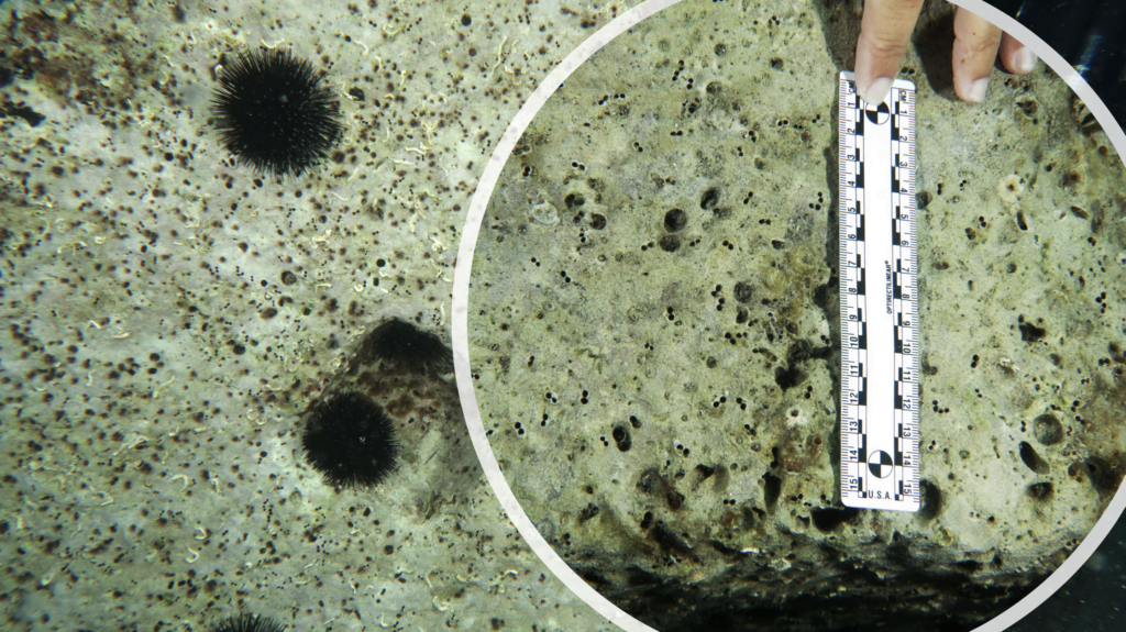
                                            Sea urchins on column section. Bioerosions by endolithic molluscs.

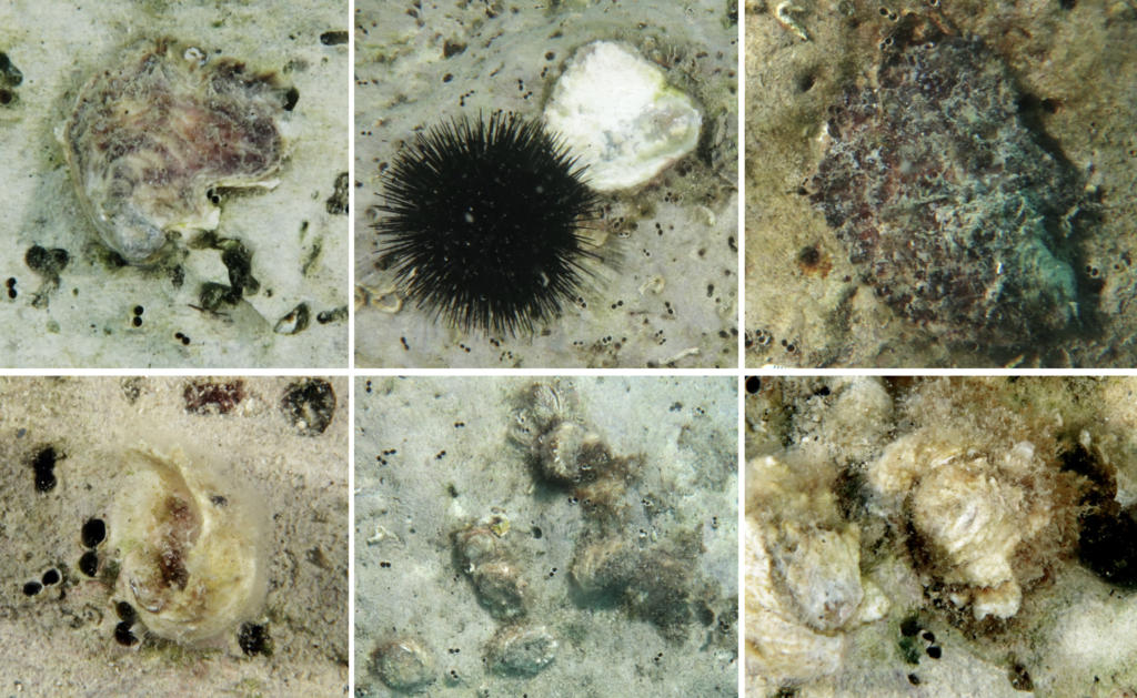
Considering the shape of the holes, it was possible to attribute this boring action to Rocellaria dubia, a bivalve mollusc frequently found on calcareous substrates.

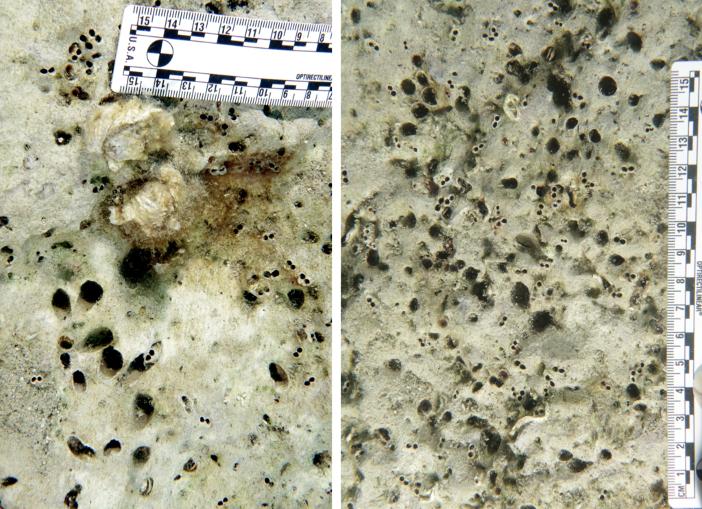
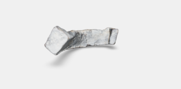
              Holes on column drums caused by Rocellaria dubia (8-shaped hole) and Lithophaga lithophaga ( sub-elliptical hole).

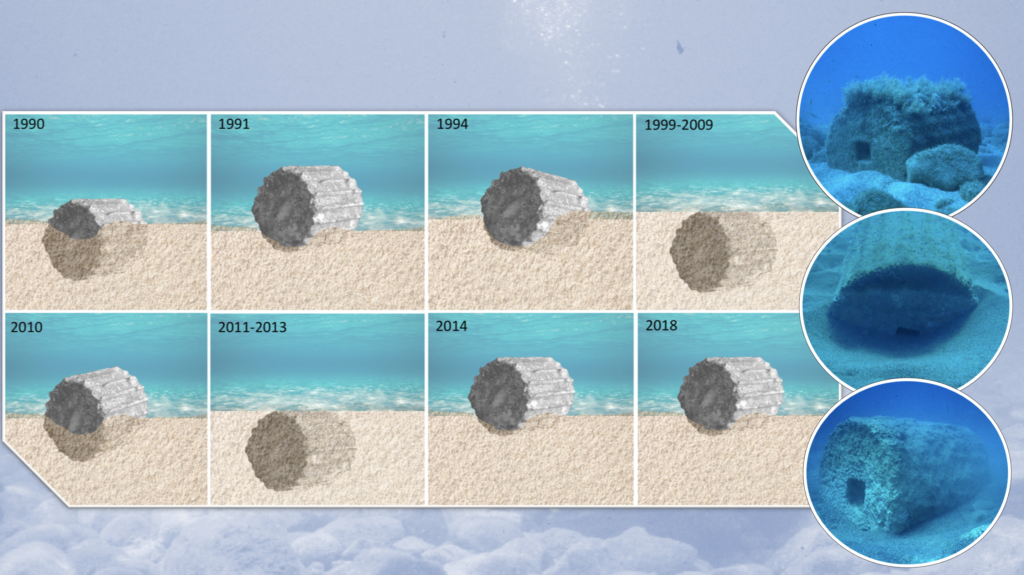
The holes are evidences for a boring action, but they do not necessarily indicate the existence of a still ongoing degradation. The perforation patterns show that various endolithic colonisations took place: the most ancient ones are distinguishable thanks to their circular or longish, wider cavities, while the more recent ones are characterized by smaller, 8-shaped openings.

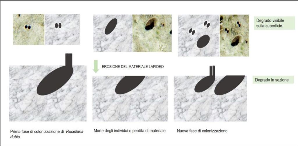
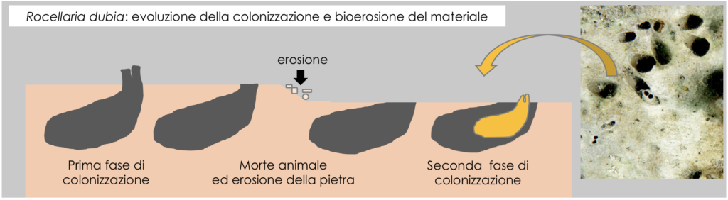
         Holes caused by endolithic molluscs Rocellaria dubia and Lithophaga lithophaga. The characteristic 8-shaped and elliptical                                  holes, respectively, are visible. Sectional diagram of the perforation inside the stone substrate

In the part dedicated to further notes, the phenomenon is described in detail, with a description of the morphology of a cavity dug by a mollusc. Over time, the considerable density of perforations caused a prominent loss of material that, in the parts most close to the surface, suffered also from erosive phenomena due to the mechanical action of waves and abrasion of the sediment on the artefact, with an ensuing loss of entire layers of stone.

Discover the finds in 3D

The planimetric positioning of the anchors found in the stretch of coast in front of the Doric temple of Kaulonìa allowed for identifying two areas of concentration. The first area returned a greater quantity of finds and is located south of the promontory of Cocynthum, the second one is close to the mouth of the torrent Assi. This is consistent with the prevailing winds of the area that, depending on the direction, allowed for a secure anchorage in the two areas to the south and to the north of the promontory.

It is worth remembering that, among the inventoried artefacts, there are also tools that can be attributed to the equipment used for delimiting underwater banks, cofferdams or foundations. In fact two iron pile shoes and a lead ferrule represent an emblematic case. These artefacts are undoubtedly an indication of the presence of structures in water, of which only a few elements survived to this day.

STONE ANCHOR STOCK

Stone anchor stock. Cuspidated block. Sketchy cavity. Missing a part of an arm. Poor workmanship. Biological degradation The anchor presents an epilithic (superficial) colonisation caused mainly by Polychaeta serpulidae with their characteristic calcareous tube, together with an endolithic colonisation, limited to some points and caused by…

LEAD ANCHOR STOCK 29

Lead anchor stock with a semi-hollow section, missing one arm. Portion of the both without the retaining peg that was supposed to be wooden. The arm has an opening that allows for glimpsing the inside. Biological degradation Lead anchor stock with a semi-hollow section, missing one…

BELL-SHAPED PLUMMET

Plummet. Bell-shaped; hollow inside. On top of the cap there is a quadrangular pierced grip. In the hollow part, some ribbings divide the space in four sectors, forming a cross-motif. Inside the bell there are encrustation made of sand mixed with another element that cannot…

PLUMMET

Plummet. Encrustations. Truncated-conical. Hollow at the base for a depth of 2-4 cm. On top of the cup there is a hole with a S-shaped section that probably contained an element for tying. There is a cavity on the base (1). Biological degradation The artefact does…

LEAD BAND

Band. Minor dents on the surface. Folded to form a rectangle. The ends were secured with nails. The upper edge is riveted. Interpretable as a reinforcement or a peg for locking a wooden element (1). Biological degradation The artefact does not present signs of biological colonisation.…

LEAD FERRULE

A rectangular large band, folded on itself. The ends are barely joining. A nail hole is located by the junction. The upper edge is riveted. Fractures. “Head” ferrule. Used for foundation works (on stilts or underwater), it was inserted on the beam head to avoid…

LEAD SLAB

A rectangular slab folded over on itself. One of the angles has a prominently curved profile. The two long sides have 12 holes arranged in a row: it seems they contained square-section nails. On the folded over side, light grooves cross the slab horizontally. The…

LEAD TUBULAR ELEMENT

Tubular element. Cylindrical shape; hollow inside. The lesser opening is riveted; by the larger one there is a nail hole. Used as a handle or a reinforcement for a wooden pole. Biological degradation The artefact does not present signs of biological colonisation. References Medaglia S. 2002, Materiali…

LEAD PLAQUE

Plaque. Fractures and crushes. Truncated-conical. Folded and rolled up on itself. Hollow inside. Lead element used for weighting a fishing line or net (1). Biological degradation The artefact does not present signs of biological colonisation. References Basile B. 1987, Recenti prospezioni subacquee nell’arco costiero fra Messina e…

IRON PILE-SHOE

Pile-shoe. Corrosions. The metal flakes off very easily. It is composed of four wings that join themselves to form a tip (1). Metallic reinforcement at the tip of a beam. Often used in ancient times, it was especially known for its usage in underwater construction.…

LEAD ANCHOR STOCK FILLING

Lead filling of a wooden anchor stock. It is composed of two parallelepiped-shape arms joined by a lead tab 3 cm long and a few mm thick. The back of the bar has a humped profile. Along the two longer sides, two protruding ribbings provide…

STONE ANCHOR

Stone anchor, “doughnut”-shaped. Stone not very compact, of grey colour with bluish veins. Stone ring with an apical square grip. Both the internal and external hoops are not compass-shaped. The use of the artefact as a deadweight for fishing nets may not be ruled out…

PIERCED STONE

Pierced stone. Apical hole. No signs of carving. Used with all likelihood in fishing as deadweight (1). Biological degradation The artefact does not present traces of biological colonisation. References MEDAGLIA 2002, p. 178 1 For this type of object and to keep the denomination “pierced stones”, see…

PIERCED STONE 78668

Pierced stone. Ovoid shape and flattened section. Four communicating holes in pairs are crossing the pebble lengthways. Human workmanship seems limited to a groove serving as a passage for fastenings, along one the extremities. Used for weighting. Biological degradation The stone shows minute sub-circular perforations caused…

STONE FLOOR SLAB

Stone floor slab. A well-squared dark grey block. Visible side smoothed; rough-hewn bottom. A triangular male floor element protrudes from one of the sides. Biological degradation The slab does not present evident traces of biological degradation, except for its vertical surfaces where whitish fouling elements can…

COLUMN BASE 14

Ionian column base. Channelled shaft. Quadrangular hole for inserting a cramp in the upper section (1). Moulded torus. Biological degradation The calcareous nature of this artefact allowed for a widespread growth of boring animals. In particular, tiny circular perforations (pitting) are caused by the growth of…

COLUMN BASE 15

Ionian column base. Channelled shaft. Quadrangular hole for inserting a cramp in the upper section (1). Biological degradation The calcareous nature of this artefact allowed for a widespread growth of boring animals. In particular, tiny circular perforations (pitting) are caused by the growth of boring sponges,…

TOP SHAFT OF A COLUMN

“Sommoscapo” (1) of a Ionian column. Upper band partially decorated with a so-called “anthemion”, a frieze of alternating palmettes and lotus flowers. Probative comparison with a similar element from the temple of Marasà in Locris, dating back to 480-470 B.C. In this case, the element…

CORINTHIAN ANPHORA

Corcyraean or type B Corinthian amphora. Slightly everted rim, cylindrical neck. Oblique handles with thickened ribbon. Ovoid body. Foot with short, flattened tip. The Corinthian amphorae were introduced to the Mediterranean in the last quarter of the VI century B.C. and their production lasted for…

CAST IRON CANNON

A muzzle-loading cast iron cannon with a prominent spherical pommel on the breech. It does not present distinctive signs for its identification, as the so-called “arma” (a heraldic emblem), a weight stamp or inscriptions on the breech ring. The distinguishable elements include a touch hole,…

STONE ANCHOR STOCK 78672

Stone anchor stock. Trapezoidal shape with tapering arms. Deep central recess. Careful shaping work. Biological degradation The artefact presents a prevalently epilithic colonisation caused by encrusting thalli of coralline algae and calcareous tubes made by Polychaeta serpulidae (sea worms). References MEDAGLIA 2002, p. 178 1 For…

STONE ANCHOR STOCK 78671

Stone anchor stock. Marine encrustations. Trapezoidal shape, with a fairly squared central cavity. Partially mutilated of one of the arms. Biological degradation The anchor presents an epilithic (superficial) colonisation caused mainly by Polychaeta serpulidae with their characteristic calcareous tube, together with an endolithic colonisation, limited to…

STONE ANCHOR STOCK 25

Stone anchor stock. Fractured. Trapezoid, beveled and rounded shape, with a central, well-squared recess. One arm missing. Biological degradation The artefact presents elements of heavy fouling by epilithic organisms. In particular, these are Polychaeta serpulidae (sea worms) that, with their characteristic calcareous tubes, form whiteish encrusting…

LEAD WEIGHTING BAR

Weighting bar with a parallelepiped-trapezoid profile. It belongs to a class of wooden anchors with a weighting made of lead. In this type, the lead was cast in two wooden cases that were part of an anchor made of the same material. According to Associazione…

LEAD ANCHOR STOCK 27

Lead anchor stock with solid section and an open-V profile. Rectangular both provided with a fixed retaining bar. Biological degradation Although the discovery of lead logs under water is practically commonplace, in reality it has not yet been possible to establish a typological serie of this…

LEAD PLUMMET

Plummet in lead, truncated cone, hollow at the base for a depth of 1-2 cm. Apical hole missing due to abrasion (1). Biological degradation The artefact does not present signs of biological colonisation. References 1 See. KAPITÄN 1961, p. 305, fig. 1 1; CHARLIN ET AL. 1978,…

LEAD BRACKET

Curvilinear lead bracket with ends bent in opposite directions. Biological degradation The artefact does not present signs of biological colonisation. References

LEAD BRACKET WITH A T-PROFILE

Lead bracket with a T-profile. It is a fastening cramp for construction materials. Biological degradation The artefact does not present signs of biological colonisation. References